Portolan Charts: Navigating the Medieval Mediterranean

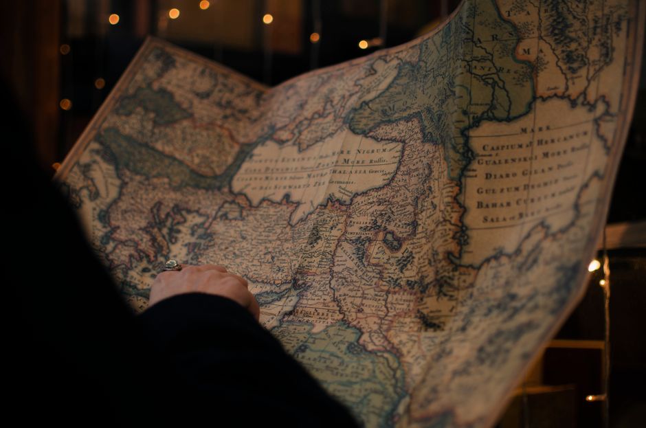
Portolan charts are a distinctive class of nautical maps that emerged in the Mediterranean during the late thirteenth century. Unlike earlier mappaemundi, which were often schematic and theological in orientation, portolan charts prioritised practical navigation. They typically depict the Mediterranean, Black Sea, and adjacent Atlantic coasts with remarkable accuracy for their time, using a network of intersecting rhumb lines to guide mariners. These charts were not merely artistic artefacts; they were working tools that facilitated trade, pilgrimage, and naval campaigns across the medieval Mediterranean.
The construction and use of portolan charts reflect a sophisticated understanding of geometry, observation, and practical seamanship. While their exact origins remain debated among historians, their impact on maritime culture is well documented. This article examines the methods behind their creation, the ways medieval sailors employed them, and the broader context in which they circulated. By exploring these aspects, we can appreciate how portolan charts helped shape the navigational practices of their era.
In the following sections, we will consider the defining features of portolan charts, the techniques used to produce them, their role in medieval navigation, and their legacy in the history of cartography.
Defining Features of Portolan Charts
Portolan charts are immediately recognisable by their dense web of rhumb lines, which radiate from multiple compass roses or focal points across the chart. These lines, also known as loxodromes, represent constant bearings and were used to plot courses between ports. The coastlines on portolan charts are drawn with a level of detail and accuracy that was unprecedented for their time, particularly around the Mediterranean basin. Names of ports, harbours, and coastal landmarks are often written perpendicular to the shore, allowing sailors to read them while orienting the chart.
Another characteristic feature is the absence of inland detail. Unlike later maps that filled interiors with cities, rivers, and mountains, portolan charts focused almost exclusively on the sea and the immediate coastline. This selective representation underscores their practical purpose: they were designed for navigation, not for general geographic reference. The charts were typically drawn on parchment, often using inks that have faded over centuries, and they varied in size from small, portable versions to large, ornate display pieces.
The accuracy of portolan charts has prompted much scholarly discussion. Some researchers suggest that they were based on direct observation and accumulated sailing experience, while others argue for the influence of older sources or even ancient maps. Regardless of their origins, the consistency of their coastlines across different charts indicates a shared body of knowledge among Mediterranean mariners.
Construction Techniques and Materials
The creation of a portolan chart was a skilled craft that combined artistry with mathematical precision. Chart makers, often based in port cities such as Genoa, Venice, or Majorca, began by preparing a sheet of parchment, typically made from sheepskin or goatskin. The surface was smoothed and treated to accept ink, and then a grid of rhumb lines was laid down using a straightedge and compass. These lines were drawn in different colours, often black, red, and green, to distinguish between different sets of bearings.
Coastlines were plotted using a combination of measurements, estimates, and copied information from earlier charts. The chart maker would place a series of points along the coast, each corresponding to a known port or landmark, and then connect them with lines that approximated the actual shoreline. The distances between these points were often based on sailing directions known as portolani, which listed courses and distances between ports. The resulting chart was a synthesis of empirical data and conventional representation.
Once the rhumb lines and coastlines were drawn, the chart maker added place names, usually in black or red ink, and sometimes decorative elements such as compass roses, ships, or sea monsters. These embellishments served both aesthetic and practical purposes, helping to orient the user and adding visual appeal. The finished chart was then sometimes varnished or covered with a protective layer to withstand the rigours of sea travel.
Use by Medieval Sailors
For medieval sailors, a portolan chart was an essential tool for navigation, especially in unfamiliar waters. Unlike modern charts, which are used in conjunction with precise instruments, portolan charts were often employed alongside oral knowledge, lead lines, and visual observation of the coast. A sailor would consult the chart to determine the bearing between two ports, then use a compass to maintain that course. The rhumb lines provided a visual guide, and the detailed coastlines helped identify landmarks and avoid hazards.
However, portolan charts had limitations. They were not designed for open-ocean navigation and were less useful beyond the familiar waters of the Mediterranean and nearby Atlantic coasts. They also did not account for the curvature of the earth or the effects of magnetic variation, which could lead to errors over long distances. As a result, sailors relied on a combination of methods, using the chart as one of several aids rather than as a sole source of direction.
Despite these limitations, portolan charts were highly valued and often passed down through generations or copied by hand. They were used by merchants, pilgrims, and naval commanders alike, facilitating the movement of goods, people, and ideas across the sea. The charts also served as status symbols for wealthy patrons, who commissioned lavish versions for display in their homes or offices.
Legacy and Influence on Cartography
The influence of portolan charts extended well beyond the medieval period. As European explorers ventured into the Atlantic and beyond, they carried with them the navigational techniques and chart-making traditions that had been refined in the Mediterranean. The principles of rhumb line navigation and coastal accuracy were adapted to new regions, contributing to the development of more comprehensive nautical charts.
In the history of cartography, portolan charts represent a significant shift towards empirical observation and practical utility. They demonstrate how mariners and mapmakers worked together to create tools that addressed specific needs, and they highlight the importance of local knowledge in navigation. While they were eventually superseded by charts that incorporated mathematical projections and global positioning, their legacy persists in the continued use of rhumb lines and the emphasis on coastal detail in modern nautical charts.
Today, portolan charts are studied by historians, geographers, and collectors, who appreciate them both as artefacts of a bygone era and as evidence of the sophisticated navigational culture of the medieval Mediterranean. Their enduring appeal lies in their beauty, their precision, and the window they offer into the daily challenges of sea travel in the Middle Ages.